
Jordan is one of the most rewarding self-drive destinations in the Middle East, offering well-paved primary corridors, dramatic desert vistas, and ancient crossroads within relatively short geographical distances. However, digital mapping applications frequently underestimate driving times across the kingdom. Steep canyon descents, unpainted agricultural speed humps, wandering livestock, and heavy logistics traffic mean that a route advertised online as three hours can quickly consume an entire travel day.
This seven-day route links Jordan’s premier cultural landmarks—Amman, Jerash, Petra, and Wadi Rum—with a relaxing conclusion on the shores of the Dead Sea. Rather than rushing between viewpoints, this plan accounts for mountain topography, visitor center checkpoints, and entry logistics.

Understanding Jordan’s Road Network: Highways 15, 35, and 65
Navigating western Jordan involves choosing between three parallel north-south arteries, each serving distinct transit and sightseeing needs:
- The Desert Highway (Highway 15): The kingdom's industrial spine runs from Amman south through Ma'an to Aqaba. It is predominantly a multi-lane, divided highway that bypasses major towns. While historically plagued by construction, the central and southern sections provide the fastest transit route between the capital, Queen Alia International Airport (QAIA), and the southern deserts. Driving speeds average 90 to 110 km/h, but watch closely for heavily loaded freight trucks.
- The King’s Highway (Highway 35): One of the oldest continuously traded routes in antiquity, this scenic mountain corridor ribbons south from Madaba through Dhiban, cuts across the massive chasm of Wadi Mujib, passes Karak Castle, and reaches Petra (Wadi Musa). Pure driving time is roughly 4.5 hours for 274 kilometers, but with stops, steep serpentine switchbacks, and village speed humps, navigating it safely requires a dedicated 7 to 9 hours. Never drive the King's Highway after dark, as guardrails are sparse, switchbacks are sharp, and road illumination is limited.
- The Dead Sea Highway (Highway 65): Descending into the Jordan Rift Valley, Highway 65 hugs the kingdom’s western perimeter along the Dead Sea before stretching south through Wadi Araba toward Aqaba. It offers smooth, low-elevation driving with minimal settlements, making it an efficient link when returning north from the southern deserts to resort areas.
Essential Entry Paperwork: The Jordan Pass
Before finalizing your flights, evaluate the unified visitor ticketing program administered by the Jordan Pass Official Portal. The pass combines the mandatory entry visa fee with pre-paid entry to over 40 historic attractions across the country.
- Tourist Visa Waiver: For eligible nationalities, purchasing the Jordan Pass online prior to arrival waives the standard 40 JOD single-entry visa-on-arrival fee, provided you remain in Jordan for at least three consecutive nights (four days).
- Tier Structure: The program offers three main tiers based on your planned time inside Petra: Jordan Wanderer (70 JOD, one day at Petra), Jordan Explorer (75 JOD, two consecutive days at Petra), and Jordan Expert (80 JOD, three consecutive days at Petra).
- What It Covers: In addition to Petra, the pass covers standard entry to the Amman Citadel, the Roman Theatre, Jerash Archaeological Site, Karak Castle, and the ASEZA Wadi Rum Directorate entry checkpoint at the Wadi Rum Visitor Center.
- What It Does Not Cover: The pass excludes the after-hours "Petra by Night" event, private Bedouin-guided 4x4 tours inside Wadi Rum, and electric shuttle transfers.
The 7-Day Jordan Route Overview
| Day | Segment & Core Focus | Highway | Pure Drive Time | Realistic Buffer | Overnight Base |
|---|---|---|---|---|---|
| Day 1 | QAIA Arrival to Amman | Hwy 15 | 45–50 min | 1 hr 15 min | Amman |
| Day 2 | Jerash Day Trip & Amman Sights | Hwy 35 North | 50 min each way | 1.5 hrs each way | Amman |
| Day 3 | Amman to Petra (Scenic Transit) | Hwy 35 (King's Hwy) | 4.5 hrs | 7–8 hrs with stops | Wadi Musa (Petra) |
| Day 4 | Petra Archaeological Exploration | Local Wadi Musa | Negligible | Full day on foot | Wadi Musa (Petra) |
| Day 5 | Petra to Wadi Rum Desert | Hwy 35 to Hwy 15 | 1 hr 45 min | 2 hrs 15 min | Wadi Rum Camp |
| Day 6 | Wadi Rum to Dead Sea Resorts | Hwy 15 to Hwy 65 | 3.5 hrs | 4.5 hrs | Dead Sea Coast |
| Day 7 | Dead Sea to QAIA Departure | Hwy 40 to Hwy 15 | 55–65 min | 1 hr 30 min | Departure |
Day 1: Arrival at Queen Alia International Airport and Amman
Morning & Afternoon: Arrival and Vehicle Collection
Arrive at Queen Alia International Airport (QAIA), situated approximately 35 kilometers south of downtown Amman. Clear immigration by presenting your pre-purchased QR code from the Jordan Pass Official Portal to claim your tourist visa fee waiver.
Pick up your rental vehicle from the airport terminal counters. Opt for a car with responsive brakes and adequate engine torque to handle the kingdom's steep hill climbs; standard front-wheel drive is sufficient for paved highways, but an all-wheel-drive crossover adds peace of mind on mountain inclines. Inspect the spare tire, tire tread, and jack before departing.
Driving Logistics
- Route: QAIA to West Amman / Downtown via Route 15 (Airport Road).
- Distance & Time: ~35 km; 45 to 60 minutes.
- Navigation Reality: The highway into southern Amman is modern, multi-lane, and well-lit, but traffic tightens significantly near the 7th and 8th Circles. Avoid arriving during Thursday afternoon rush hours (15:00 to 18:00), when outgoing commuter traffic peaks.
Evening: Jabal Amman and Downtown
Check into your hotel in Jabal Amman or Weibdeh. Spend the evening strolling Rainbow Street, sampling local mezze, and resting after your flight.
Day 2: The Ruins of Jerash and Amman’s Ancient Core
Morning: Exploring Jerash Archaeological Site
Depart Amman by 08:00 to travel north toward Jerash, one of the best-preserved Decapolis Roman cities in the world.
- Driving Logistics: Amman to Jerash via Route 35 North (~48 km; 50 to 60 minutes). Route 35 traverses hilly terrain with moderate local traffic and routine police checkpoints. Keep your passport and rental agreement accessible.
- Sightseeing: Enter Jerash using your Jordan Pass. Spend 2.5 to 3 hours wandering Hadrian’s Arch, the Oval Plaza, the Cardo Maximus, and the North Theatre. The morning sun illuminates the western colonnades before afternoon heat sets in.
Day 2 Route Segment:
Amman [Hwy 35 N] ──> Jerash Ruins (3 hrs on site) ──> Amman Citadel & Roman Theatre
Afternoon: The Citadel and Roman Theatre in Amman
Drive back to Amman for a late lunch. Head directly to Jabal al-Qal'a to visit the Amman Citadel, offering sweeping views of the city's stepped hillsides, the Temple of Hercules, and the Umayyad Palace. Descend into the lower valley to explore the 6,000-seat Roman Theatre, also included in your unified pass.
Evening: Amman Food Culture
Walk the bustling downtown souks near Al-Balad. Sample fresh knafeh from traditional sweets shops before turning in early ahead of the following day's long drive.
Day 3: Amman to Petra via the Scenic King’s Highway
Depart your Amman accommodation by 07:30. This is the most demanding and picturesque driving day of the trip. Plan your journey using official route updates from the Jordan Tourism Board.

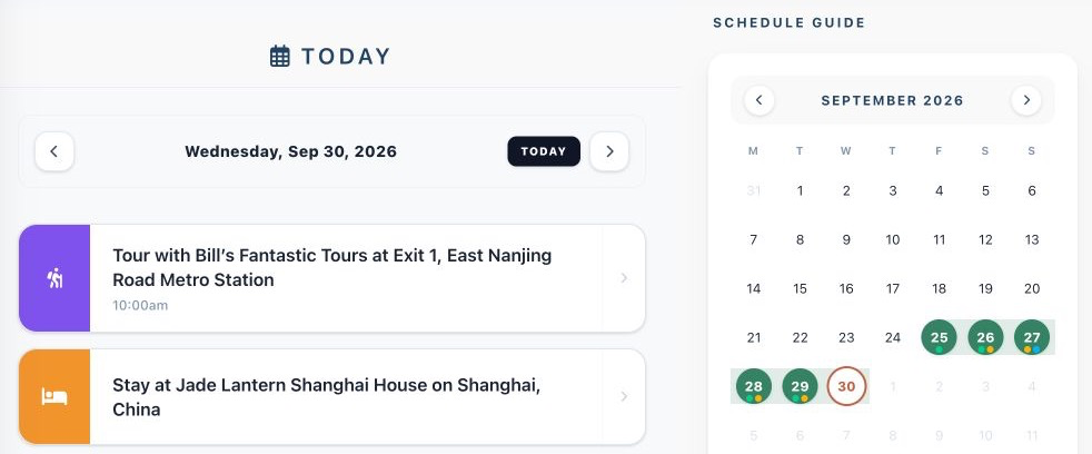
Suitcase2Go web app — demo data. Use trip planning tools to sequence scenic roadside stops, driving segments, and hotel confirmations along multi-city routes.
Morning: Madaba, Mount Nebo, and the Wadi Mujib Canyon
- Madaba (08:15): Stop at the Church of Saint George to view the 6th-century Byzantine mosaic map depicting the Holy Land. Allow 45 minutes.
- Mount Nebo (09:30): Drive 15 minutes west to the memorial church of Moses for expansive panoramas stretching toward the Jordan Valley.
- The Grand Canyon of Jordan (11:00): Rejoin Highway 35 heading south through Dhiban. The road descends over 700 vertical meters into the canyon floor of Wadi Mujib before climbing the opposite wall. Allocate 30 minutes for scenic photo stops at canyon overlooks.
Afternoon: Karak Castle
- Karak (13:00): Arrive at the imposing Crusader fortress of Karak. Navigate the subterranean stone vaults and defensive battlements (entry included in the Jordan Pass). Plan 1.5 hours on-site, plus 45 minutes for a sit-down lunch in town.
- Southern Ascent to Petra (15:00): Continue south along Highway 35 past Tafilah and Shobak. This segment features winding two-lane roads with agricultural trucks and unmarked speed humps across small settlements.
King's Highway Driving Breakdown:
Amman ──(45m)──> Madaba ──(1h 30m)──> Wadi Mujib Overlook ──(1h 15m)──> Karak Castle ──(2h 15m)──> Wadi Musa
Total Transit Window: 7.5 to 8.5 hours (including sightseeing and lunch)
Evening: Arrival in Wadi Musa
Arrive in Wadi Musa (the gateway town to Petra) before sunset (typically 17:30 to 18:00 depending on the season). Check into your hotel, refuel your car, and purchase water and trail provisions for tomorrow's trek.
Day 4: Full Day at the Petra Archaeological Park
Dedicate the entire day to exploring the ancient Nabataean capital on foot. Standard ticket fees, trail regulations, and seasonal gate times are maintained on the Visit Petra — PDTRA Official Portal.
Morning: The Siq and The Treasury
- Timing: Arrive at the visitor center at gate opening (06:00 from March to October; 06:30 from October to March). Early arrival lets you walk through the dramatic 1.2-kilometer Siq canyon in tranquil morning light before tour bus crowds arrive.
- The Treasury (Al-Khazneh): Step out of the canyon to view the iconic facade. Continue onward through the Street of Facades, the Theatre, and the Royal Tombs.
Midday: The Monastery Hike (Ad-Deir)
Cross the Colonnaded Street past the Great Temple and Qasr al-Bint. Begin the 850-step climb up the mountain trail to the Monastery (Ad-Deir). The trail features cliffside viewpoints and shaded Bedouin stalls selling tea and fresh pomegranate juice. Take a prolonged rest at the plateau plateau cafe facing the monumental facade.
Afternoon: The High Place of Sacrifice or Back Trail Return
If you have stamina remaining, return via the High Place of Sacrifice trail for views over the central valley. Alternatively, reverse your route down the main colonnade. You will easily log 18,000 to 25,000 steps by mid-afternoon.
Evening: Optional Petra by Night
Rest at your hotel. If your visit falls on a scheduled evening (Sunday through Thursday, 20:30–22:30), you may attend "Petra by Night," which illuminates the Siq and Treasury with thousands of candle lanterns. Note that this requires a separate ticket (30 JOD) and is not covered by the Jordan Pass.
Day 5: Petra to Wadi Rum Desert
Morning: Scenic Drive to the Protected Area
After breakfast, depart Wadi Musa south toward the red desert. The drive winds up the mountain ridge before joining the fast-moving Desert Highway.
- Route: Wadi Musa via Highway 35 south to Highway 15, exiting onto Wadi Rum Road.
- Distance & Time: ~110 km; 1 hour 45 minutes to 2 hours.
- Checkpoint Procedures: Pull into the Wadi Rum Visitor Center before Rum Village. Present your passport and Jordan Pass (or pay the statutory 5 JOD fee) to receive official park entry clearance from the ASEZA Wadi Rum Directorate.
Vehicle Regulations in the Desert
Standard rental cars cannot be driven into the protected desert dunes. Paved road ends at the Rum Village Rest House, where authorized parking lots are provided. Do not attempt to drive two-wheel-drive or standard all-wheel-drive passenger vehicles into the sands; roadside extraction is costly and damages fragile desert ecosystems. Your designated Bedouin camp hosts will meet you at the parking area in a modified 4WD truck.
Afternoon: Bedouin 4x4 Excursion
Board your host's open-back 4x4 vehicle for a 4- to 5-hour excursion through the protected landscape. Typical stops include:
- Lawrence’s Spring and the Khazali Canyon inscriptions
- The red sand dunes of Um Ishrin
- The natural sandstone spans of Um Fruth Rock Bridge
- Sunset watching from sweeping rocky plateaus
Evening: Traditional Zarb Dinner
Return to your desert camp for an authentic zarb dinner—meat and vegetables slow-cooked under sand in an underground barbecue oven. Enjoy night-sky stargazing beneath clean desert air away from light pollution.
Day 6: Wadi Rum to the Dead Sea via the Jordan Rift Valley
Morning: Desert Sunrise and Vehicle Retrieval
Watch the desert sunrise over the sandstone monoliths. Eat breakfast, pack your gear, and take your host's 4x4 transfer back to the vehicle parking lot in Rum Village.
Driving Logistics: Valley Transit
- Route: Wadi Rum Road to Highway 15 North, connecting to Route 65 (Dead Sea Highway) heading north through the Rift Valley.
- Distance & Time: ~300 km; 3.5 to 4 hours pure driving.
- Road Character: Route 65 runs parallel to the Arava border through flat desert before descending toward the Dead Sea basin at roughly 430 meters below sea level—the lowest land elevation on Earth. Watch for crosswinds, dust devils, and military checkpoints along this frontier route.
Day 6 Drive Profile:
Rum Village ──(45m)──> Hwy 15 Transfer ──(1h)──> Route 65 Rift Valley ──(2h)──> Dead Sea Resort Area
Total Distance: ~300 km | Driving Time: ~3.5 to 4 hours
Afternoon: Floating at the Lowest Point on Earth
Check into a resort along the northern hotel zone of the Dead Sea (Sweimeh). The mineral-dense water allows effortless floating. Cover yourself in therapeutic mineral mud, rinse off in freshwater beach showers, and watch the sun dip across the western cliffs.
Evening: Recovery and Sunset
Enjoy a peaceful dinner overlooking the illuminated shoreline. After several days of mountain driving and trail trekking, an evening at sea level offers ideal recovery.
Day 7: Dead Sea to Queen Alia Airport Departure
Morning: Leisurely Departure Preparation
Enjoy breakfast by the water. If your flight leaves in the late afternoon or evening, take a short morning detour up to the panoramic Dead Sea Viewpoint or relax by the pools.
Driving Logistics: Ascending to the Plateau
- Route: Dead Sea northern hotel area via Highway 40 / Na'ur bypass, connecting south onto Highway 15 (Airport Road).
- Distance & Time: ~55 to 65 km; 60 to 75 minutes.
- Elevation Change: You will ascend over 1,200 vertical meters from the Dead Sea basin up to the central plateau near the airport. Monitor engine coolant temperatures during prolonged uphill grades.
Vehicle Return and Check-In
Return your vehicle at QAIA with a full fuel tank. Arrive at the terminal three hours ahead of scheduled international flights to comfortably clear standard vehicle check-in, border security, and departures processing.
Driving Realities: Essential Road Rules and Hazards
- Unmarked Speed Humps: Town entrances and rural intersections across Jordan feature severe asphalt speed humps. Many are unpainted. Approach all roadside buildings, pedestrian crossings, and school zones slowly.
- Routine Police Checkpoints: Tourism security and traffic police maintain checkpoints throughout primary corridors. Officers are courteous to international travelers. Maintain a clean vehicle cabin, wear seatbelts, and have your rental contract, driving license, and passports ready.
- Navigation and Mobile Data: Download offline mapping areas for central and southern Jordan prior to leaving Amman. Cell coverage can drop along deep canyon descents in Wadi Mujib and the southern expanses of Wadi Araba.
- Fuel Management: Major filling stations are frequent along the Desert Highway (Route 15) and around Amman, but sparse along the King’s Highway (Route 35) and deep inside Wadi Rum. Top off your tank whenever the gauge drops below half, and ensure you have cash (JOD) on hand, as rural station card readers can experience offline errors.
Coordinating Your Jordan Route with Suitcase2Go
Sequencing a multi-city driving journey across mountain highways and desert camps requires keeping confirmation vouchers, pass barcodes, and travel timetables organized in one dependable spot.

Using Suitcase2Go, you can log your accommodations across Amman, Wadi Musa, and Wadi Rum alongside car rental pickup vouchers and Jordan Pass documents. By setting realistic road segments between morning departure times and evening hotel arrivals, you ensure each day's driving window is buffered against unexpected mountain traffic and daylight limits.